Core Survey Service
Mobile Corridor Mapping
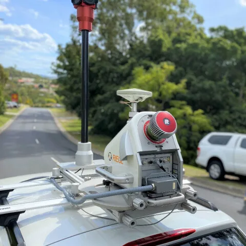
Our mobile LiDAR service supports high-efficiency capture from vehicle, rail, and marine platforms. We process dynamic datasets through trajectory optimisation, calibration, and strip alignment to maintain survey-grade consistency along linear and urban corridors.
Products Delivered
- Corridor point clouds and extracted assets
- Clearance analysis layers
- Classified terrain products
- GIS/CAD-ready datasets for operational use
End Users
- Road and rail authorities
- Port and coastal teams
- Utilities and smart city programmes
- Infrastructure consultants and asset managers
Related projects: View featured mobile corridor mapping projects.